Background:
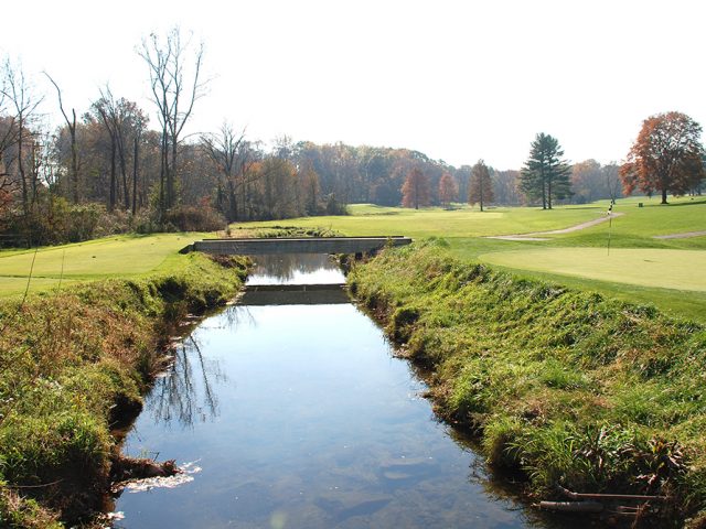
The Upper East Branch Red Clay is a 3.17 square mile catchment area in East Marlborough and Kennett Townships. The headwaters are located near East Doe Run Road along Route 926. The main stem begins at a pond in a residential development above Route 926 and an eastern tributary begins on property owned by Longwood Gardens. Land uses include the Unionville Chadds Ford High and Middle Schools, residential developments, agriculture including field crops and horses, recreational uses including the Kennett Square Golf and Country Club and Nixon Park, and forested areas. The upper East Branch Red Clay is classified by PADEP as Trout Stocked Fishery/Migratory Fishery.
Activity Summary
- The Laffey-McHugh Foundation funded a Watershed Restoration Plan, completed by Clauser Environmental in November 2010
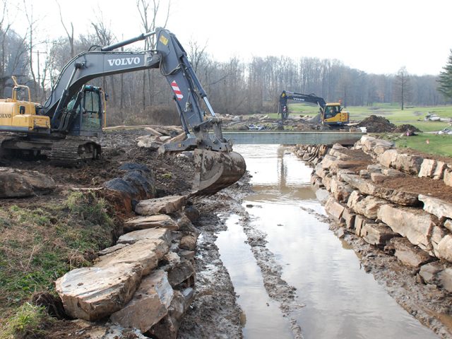
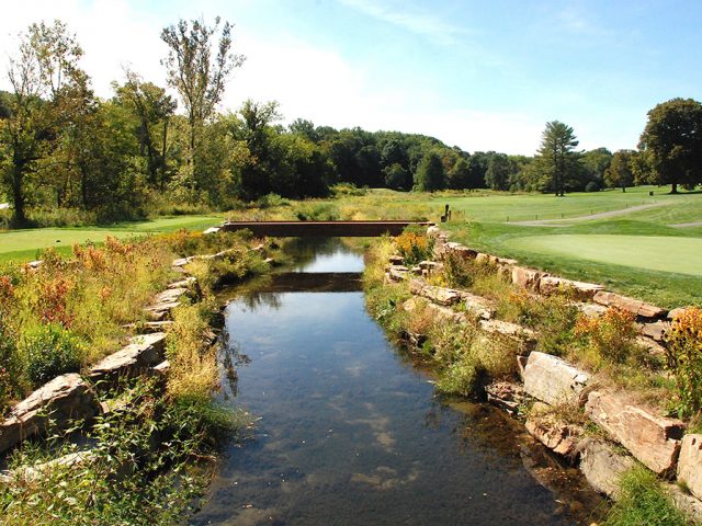
- Completed stream restoration project on 2,000 feet of the upper east branch Red Clay at Kennett Golf and Country Club in 2012. Grants from PADEP’s Growing Greener program and the Dockstader Foundation and funds from the Kennett Golf and Country Club supported the construction.
- Completed restoration of 1,200 feet of upper east branch Red Clay in 2015 with funding from PADEP Growing Greener
- Planted over 500 trees along restored stream
- Restored 1,600 feet of stream in 2017 at a horse farm that also included a livestock stream crossing and water access, 35 ft. fenced buffer and animal walkways to prevent erosion and manage manure. Project funded by National Fish and Wildlife Foundation (NFWF), SUEZ Water, CSX Rail, Stroud Water Research Center, USDA and BRC.
- Three restoration projects are complete on 4,800 feet of stream with two projects in progress to restore 1,800 feet at Anson B. Nixon Park.
Map and Restoration Plan:
Update: