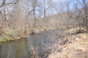
The Brandywine Creek Watershed
The Brandywine Watershed covers 330 square miles beginning in the 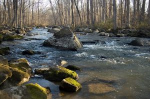 Honey Brook area of northern Chester County including Coatesville, Downingtown, West Chester and the central part of Chester County and ending in Wilmington, Delaware where it joins the Christina River. The source of the Brandywine Creek is in the Welsh Hills near Honey Brook. Both the east and west branches begin in that area. From top to bottom the stream traverses about 60 miles. The west branch flows through the City of Coatesville, the east branch through the Borough of Downingtown. The two branches join at Lenape and flow southward as the main stem through Chadds Ford, crossing the Delaware state line. Flowing through the protected lands of Brandywine Creek State Park and First State National Historical Park at Beaver Valley, the Brandywine flows into Wilmington meeting the tidal Christina River just before it meets the Delaware River.
The Brandywine Watershed is the home to over 300,000 people. About 85% of the watershed is in Chester County, Pennsylvania and the lower 15% in New Castle County, Delaware.
The Brandywine Creek supplies the drinking water for the City of Wilmington, Coatesville, Downingtown, West Chester and areas surrounding those cities and boroughs. On an average day about 30 million gallons are taken from the Brandywine Creek for residential, commercial and industrial use.
There are three major wastewater treatment plants in the watershed at Downingtown, Coatesville and West Chester. These three plants along with several smaller plants and an industrial treatment plant at the ArcelorMittal Steel facility in Coatesville treat about 11 million gallons daily.
Flows in the Brandywine Creek vary throughout the year. Levels at Chadds Ford can range from over three hundred million gallons a day in the higher flow seasons during the spring to less than 50 million gallons a day during low flows in late summer. Streamflows can be augmented by discharges from Marsh Creek Reservoir and Chambers Lake. Under normal flow conditions treatment plant effluent makes up three to five percent of the streamflow and during the extremes of historic low flow about 30 percent.
The Brandywine Creek provides recreation for fishermen as well as water for canoeing and kayaking. The Brandywine is stocked by the Pennsylvania Fish Commission in the spring at a number of locations. In addition, local sportsman’s groups also work to improve stream quality and provide fish for stream stocking.
The Brandywine Watershed has been a showcase for conservation programs which Brandywine Red Clay Alliance (BRC) began in 1945. Farmers employ modern conservation practices, industries have been leaders in reducing water use and treating wastewater, spray irrigation was introduced into the watershed in 1972 and is now found in many municipal and private systems throughout the valley. In 1955 BRC initiated the planning which resulted in the Brandywine Watershed Work Plan for flood control and water supply. The resulting structures include Marsh Creek Reservoir, Chambers Lake and flood control dams at Struble Lake, Barneston and on Beaver Creek. These dams have helped to reduce the extremes of flooding and drought in the Brandywine Watershed. Today our focus has been on stream restoration of six headwater streams and tributaries through our Red Streams Blue program and working with municipalities and landowners.
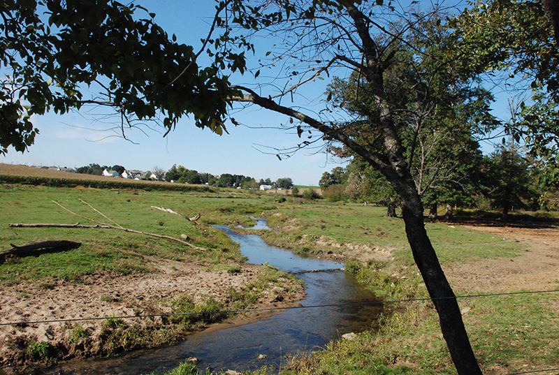
The Red Clay Creek Watershed
The Red Clay Creek , through which 43 million gallons of water flow daily, encompasses fifty-five square miles of rolling hills, woodlands, and farms in Chester County, Pennsylvania and New Castle County, Delaware. The watershed is the home of nearly 50,000 people who live in small towns and suburban and rural settings, as well as to businesses, parks, recreation sites and many of the world’s famous mushroom farms.
The Red Clay Creek Watershed originates in the rural and agricultural communities of southern Chester County, Pennsylvania including the following municipalities; East Marlborough Township, Kennett Township, Kennett Borough and New Garden Township. Flowing into northern New Castle, Delaware, the watershed includes the communities of Yorklyn, Hockessin, Marshalton and Stanton where the creek meets the White Clay Creek and flows into the tidal Christina River at Churchman’s Marsh.
BRC has been a leader in the protection of the Red Clay Watershed since 1952 including projects, such as stream restorations and the Red Clay Creek Cleanup, Our conservation partners have also improved the watershed through spray irrigation systems, open space preservation and creation of new parks, the Red Clay Valley Scenic Byway (Delaware) and the development of trails and recreational opportunities.
The Christina Basin Watershed
The Brandywine Creek and Red Clay Creek, join the White Clay Creek and Christina River which makes of the Christina Basin Watershed. Encompassing 565 square miles, the Christina Basin represents our deep historical, cultural and natural history from native peoples to early settlement, the beginning of the industrial era and modern suburban and urban life. The Christina Basin Watershed flows into the Delaware River in Wilmington.
Today BRC continues to protect and improve the Brandywine and Red Clay Watersheds through the Red Streams Blue Program. As lead coordinator of the Christina Watersheds Municipal Partnership (CWMP) we work with 38 municipalities, private and business land owners, regulators and our conservation partners,helping to coordinate a watershed approach to preserve these vital natural resources.
The Delaware River Watershed
Our Brandywine and Red Clay watersheds are part of the Delaware River Watershed that includes 4 states, flowing from the Catskill Mountains in New York through Pennsylvania, Delaware and New Jersey, and into the Delaware Bay and Atlantic Ocean.
Since 2014, BRC is proud to be part of a comprehensive four state effort to protect the Delaware River and Bay through the Delaware River Watershed Initiative funded by the William Penn Foundation. As part of the Brandywine – Christina Cluster, we’re working with six conservation partners; Brandywine Conservancy, Natural Lands, Stroud Water Research Center, The Nature Conservancy (Delaware Chapter) and University of Delaware Water Resource Center to coordinate our efforts with a 6 year action plan. Bringing our strengths in stream restorations and municipal coordination, we’re combining our work with our partner’s strengths in land preservation, agricultural improvements and urban stormwater management to improve the Christina Basin Watershed for all who live upstream and downstream.